Metro tunnel deformation monitoring
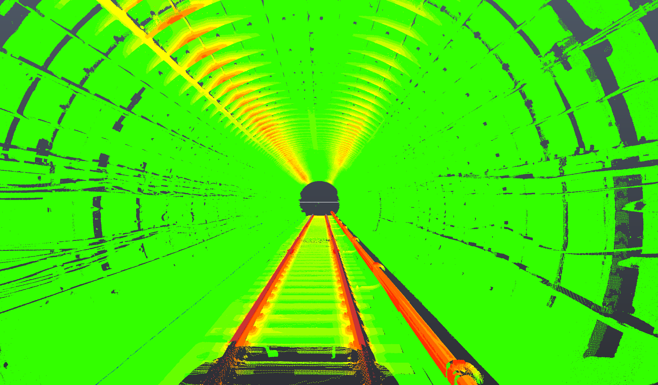
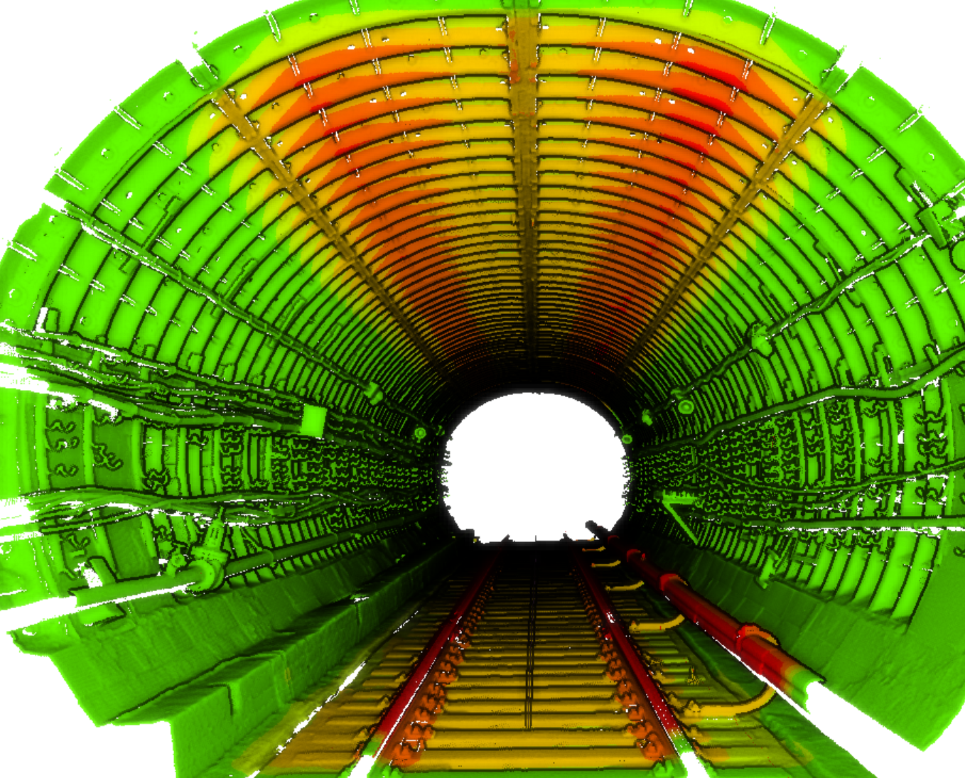
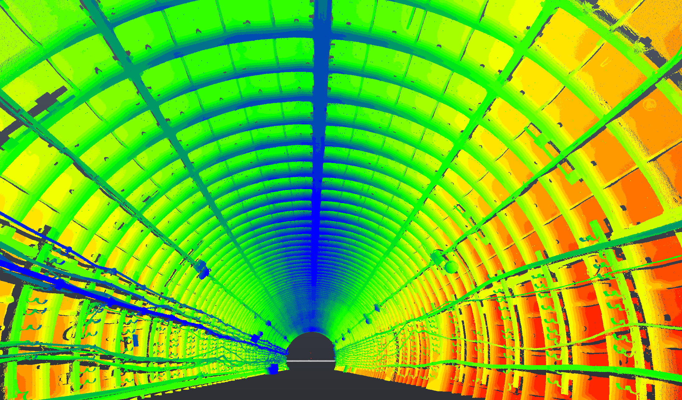
SPM3D supported an infrastructure monitoring project for a metro station tunnel in Kyiv. The tunnel area was scanned with RTC360-class terrestrial laser scanners to capture the current geometry of the lining, track area, drainage zone and visible services.
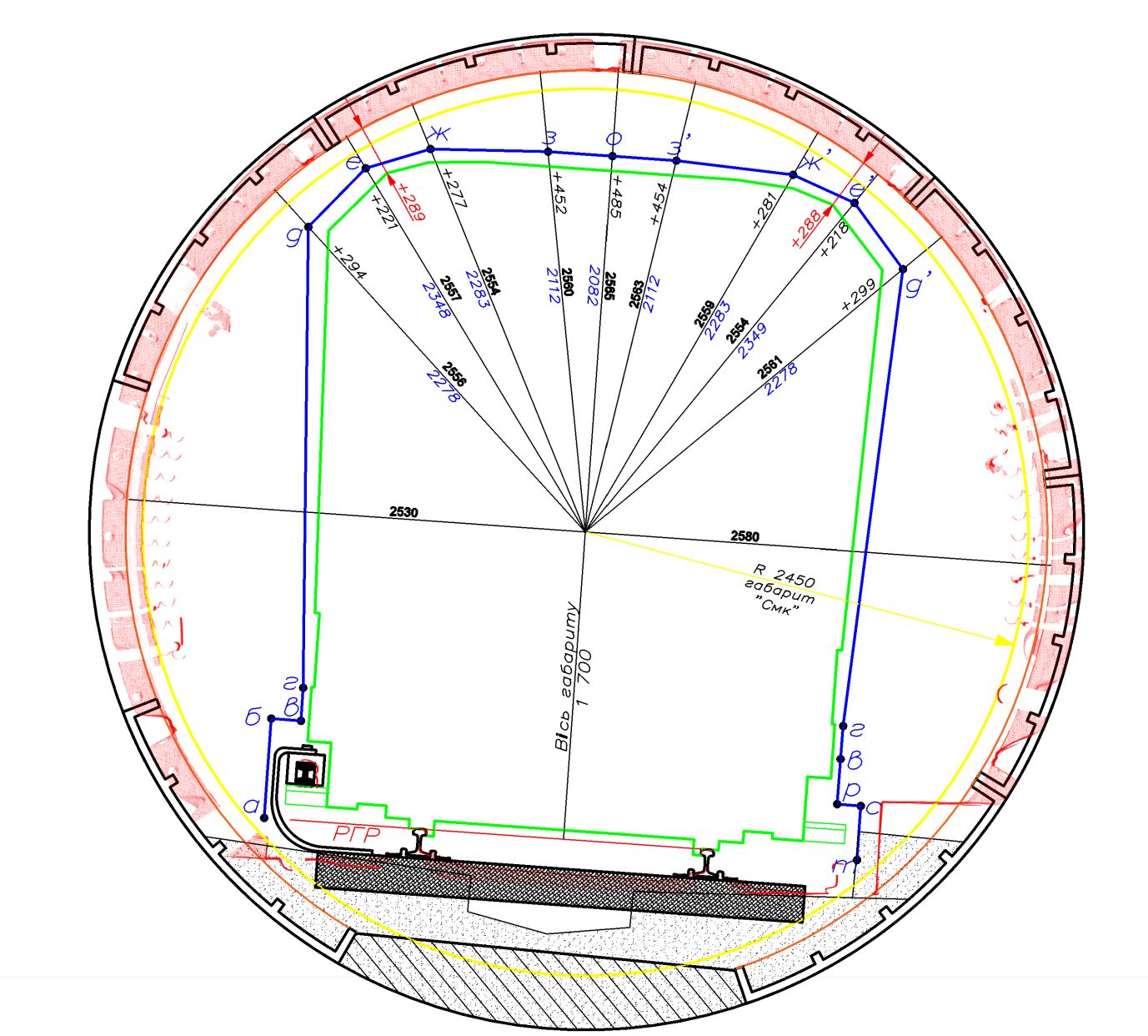
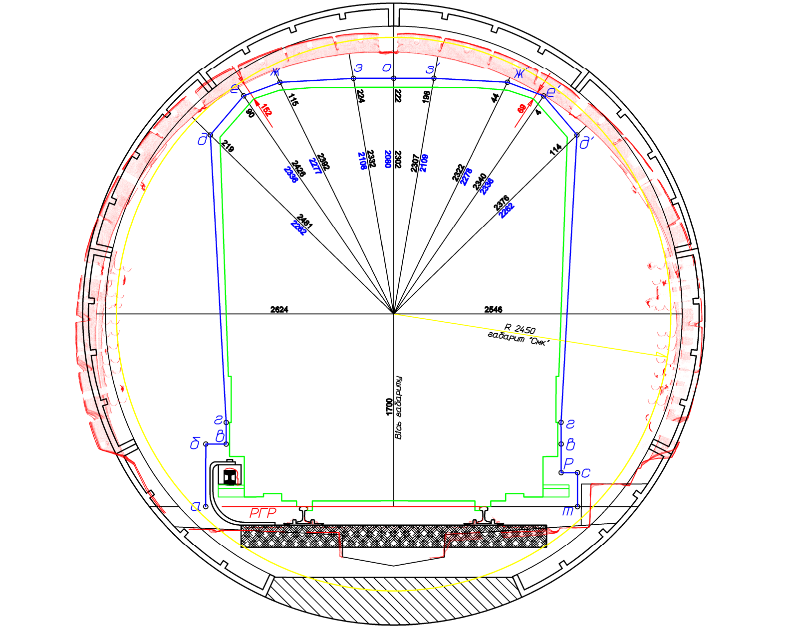
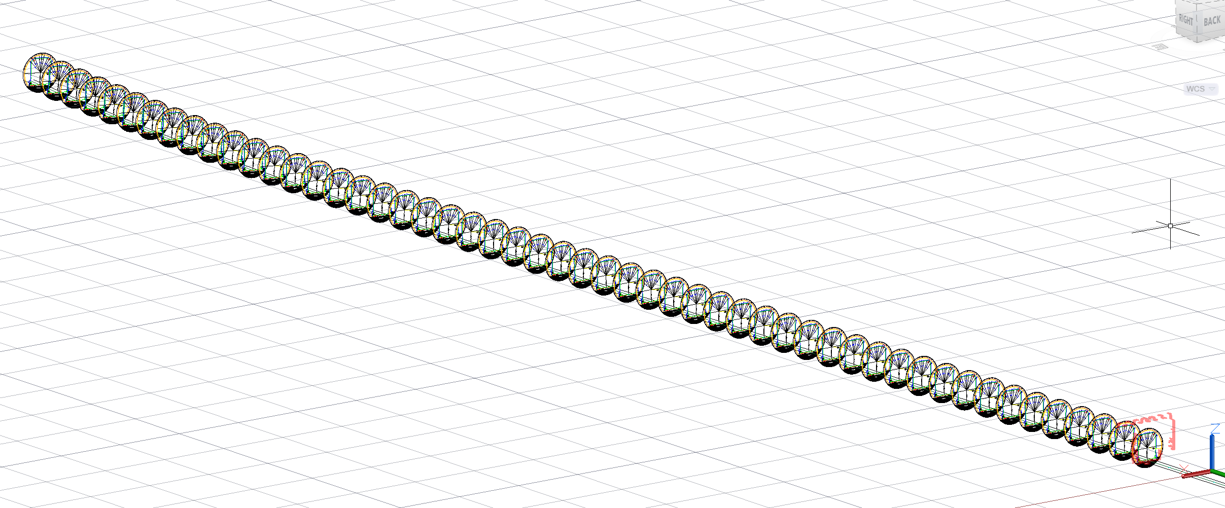
The registered point cloud was compared with the reference design profile. Cross-section profiles were generated every 5 m along the tunnel, allowing engineers to see where the real tunnel followed the design and where deformation became critical.
The analysis identified zones where the tunnel crown moved downward while the side areas widened. SPM3D produced 2D documentation, profile sheets, clearance maps and deformation visualisations, supported by custom code for repeatable point-cloud measurements and reporting.