Point-cloud analysis deliverables shaped for production teams.
We compare scan data to design intent or previous surveys to find deformation, deviation, clearance and geometric conditions.
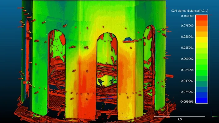
Deviation Maps
Color maps and sections communicate where geometry differs from design, previous scans or reference planes.
Measurements
Profiles, clearances, volumes, slopes and settlement indicators are extracted from the cloud.
Reports
Findings are packaged as visual reports with supporting CAD, images or data files as needed.
Baseline Setup
We define the reference model, coordinate system, tolerances and reporting format before analysis.
Computation
Clouds are compared, sectioned and measured using the agreed methodology.
Review
Results are delivered with clear visuals and notes so teams can act on the findings.
Measured deviation, clearance and deformation analysis from point clouds.
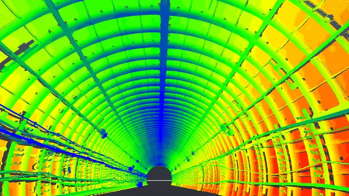
Point cloud analysis turns scan data into engineering evidence: deviation maps, profile comparisons, clearance checks, deformation measurements and visual reports that show where a structure differs from design or from a previous scan.
This is useful for tunnels, domes, floors, staircases, facades and industrial assets where millimetre-level differences affect safety, installation or construction decisions.